Events
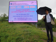
STUDIUM GENERALE "SEISMIC TOMOGRAPHY ON GLOBAL, REGIONAL AND LOCAL SCALE"
Date: May 26, 2010
Venue: Global Hall JINYU (C1-2), Katsura Campus, Kyoto University
Organized by:
Kyoto University Global COE Program"Global Center for Education and Research on Human Security Engineering for Asian Megacities"
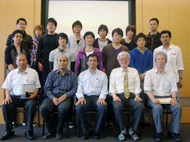
Number of attendants: 60 - 70
Poster
Report 104
Outline
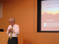
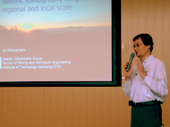
The purpose of this stadium general is to obtain recent advanced imaging technology in geosciences that has been achieved by Prof. Sri Widiyantoro. He is one of seismic tomography pioneers and one of the best ex-students of Prof. Brian Kennett, who has given a presentation in a GCOE Seminar on March 25th, 2010. His lecture showed the picture of the earth subsurface on global, regional and local scales, and its implication to the earthquake disaster prevention.
Report
The lecture of Prof. Sri Widiyantoro was opened by Prof. Toshifumi Matsuoka, which explain the curriculum vitae of presenter. Prof. Widiyantoro finalized his B.Sc degree from Institut Teknologi Bandung (ITB), M.Sc degree from Kyoto University and his Ph.D degree from Australian National University (ANU). His lecture, which was delivered in 90 minutes, consisted of the basic theory explanation of tomography in geosciences and several case studies that have been conducted by himself and his students.
In the case studies on global and regional scales, he showed several earth sections and slices, in which the interaction between plates (e.g. subductions and collisions) could be seen and identified very clear from the velocity anomalies on those pictures. Some pictures have been published in several famous journals, such as The Science and Geophysical Journal Internationals. In the case studies of local scales, he showed several pictures earth subsurface, e.g. which taken from Guntur Volcanoes in West Java. The suspected location of magma chamber could be interpreted from the velocity and attenuation anomalies beneath that volcano.
At the end of his lecture, he showed a new hazard zonation map of Sumatra and Indonesia, which was produced by "The 9-team members" (mostly consists of several geoscientist and civil engineers from ITB) and sponsored by the government of Australia. This map could replace old version of map, in which several new aspects were considered during the development of this new map. Intensive discussion was also carried out after he finalized his lecture.